![CN Tower Aerial](https://images.squarespace-cdn.com/content/v1/5006edb7c4aabfac58363d93/1653922368825-3MYLVUDXMJWHBDDIYSWV/WEB_WFTO_Aerial-Selections-68.jpg)
Aerial Toronto 2021
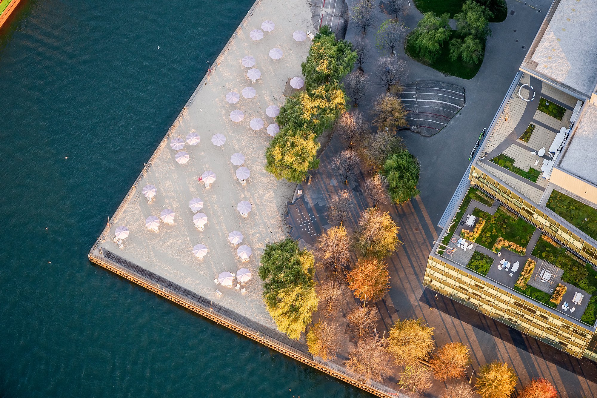
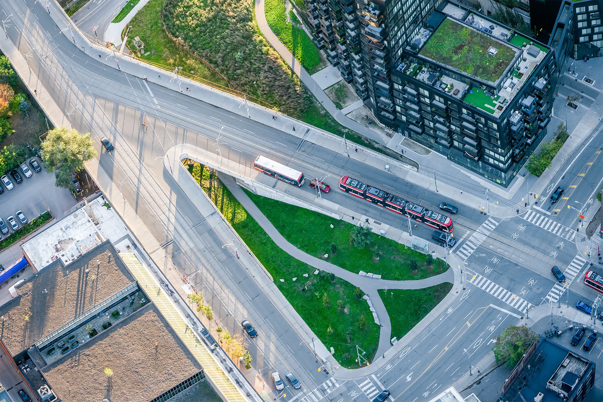
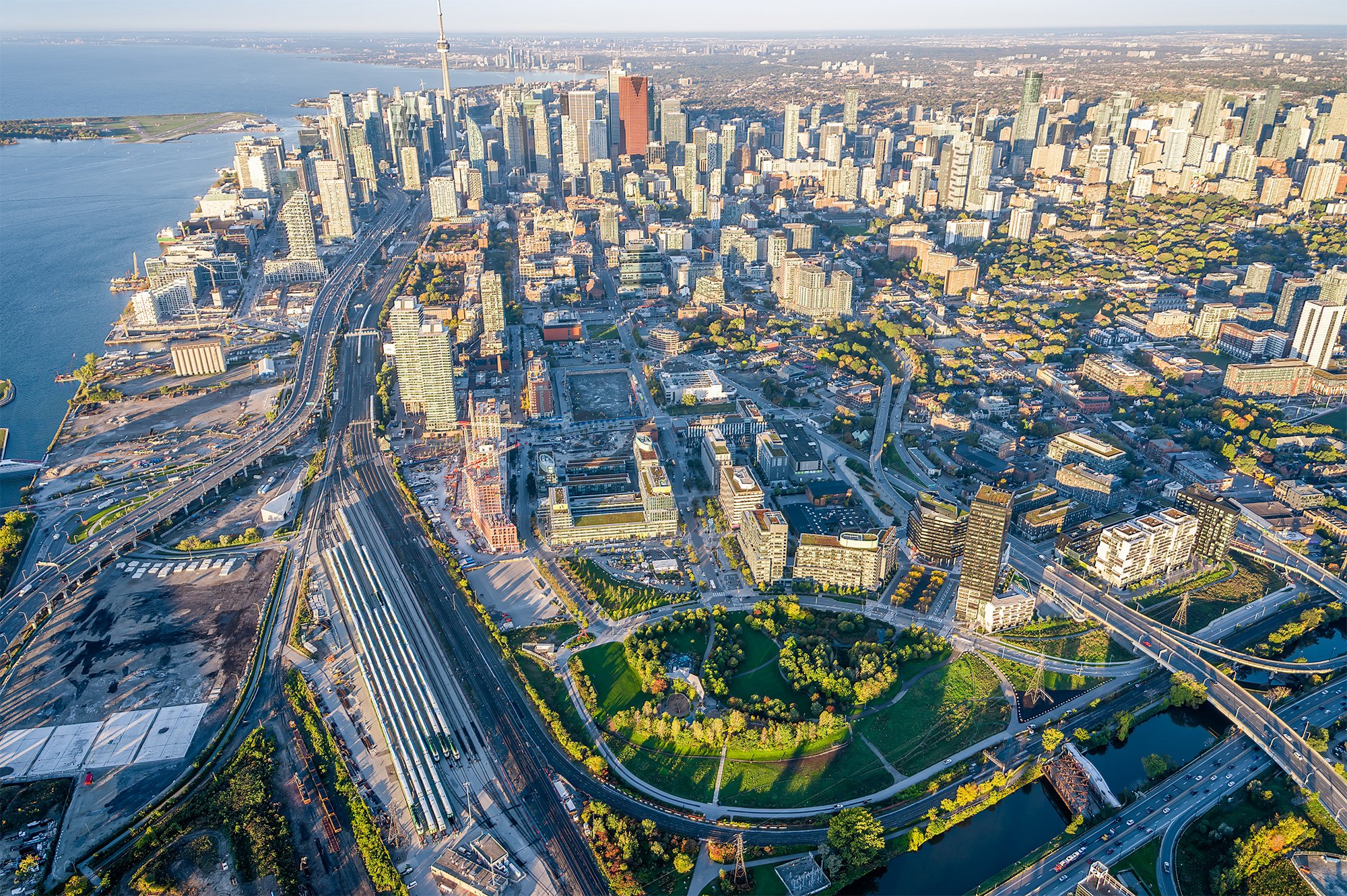
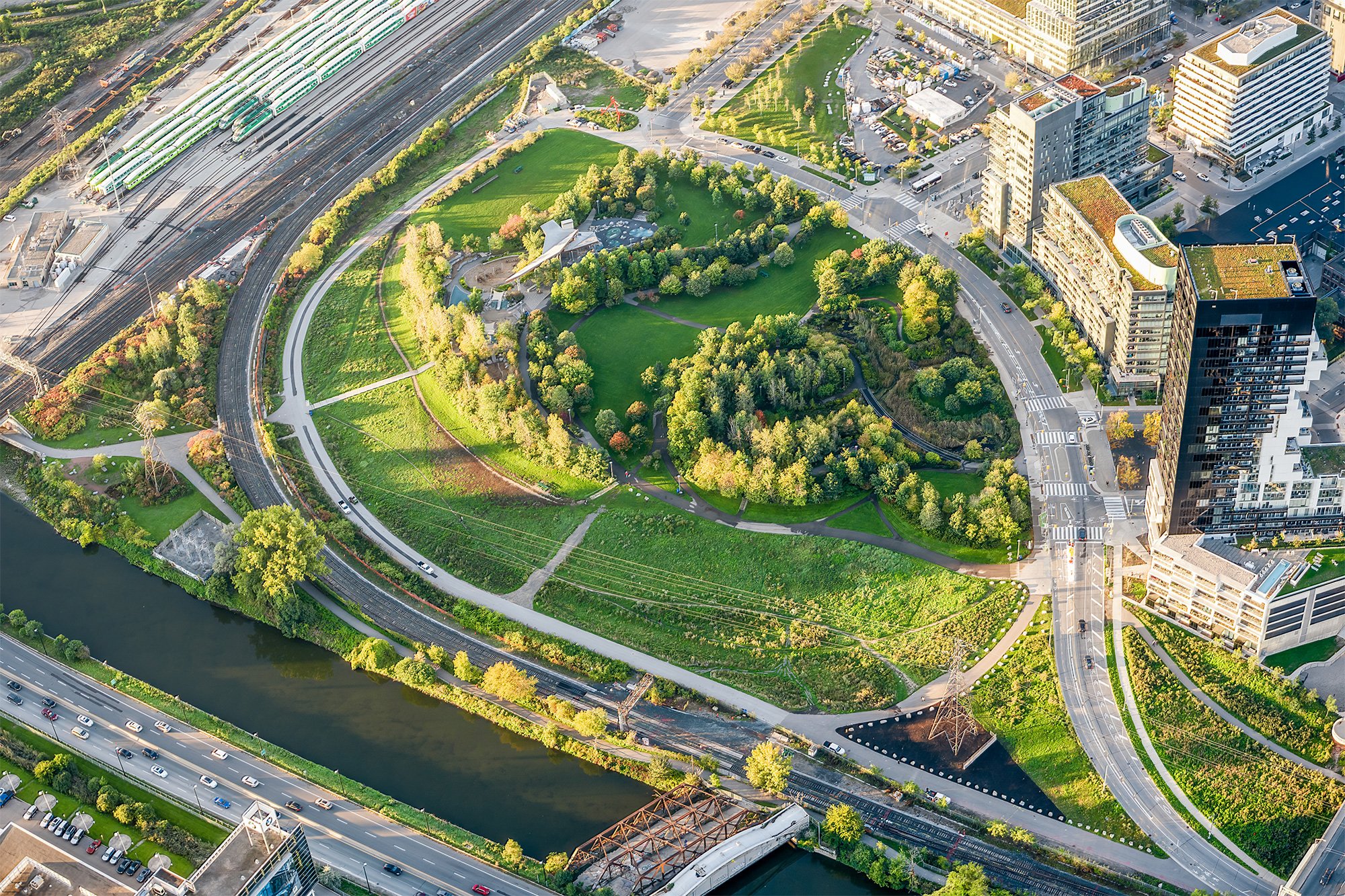
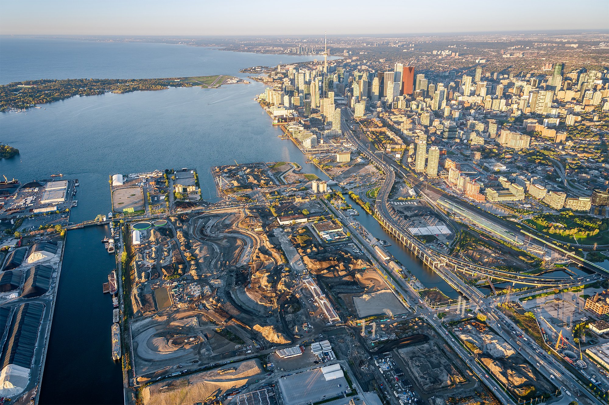
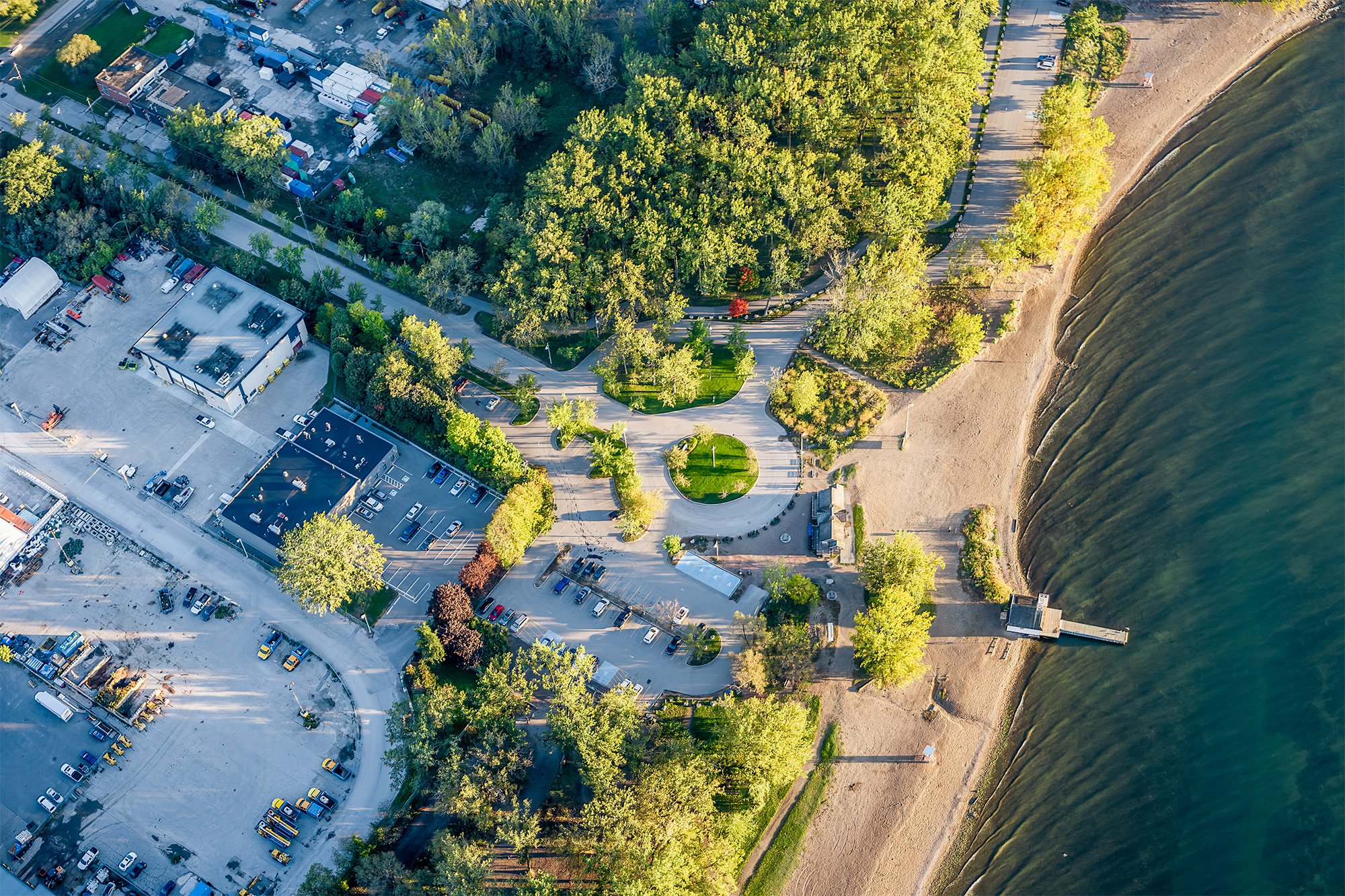
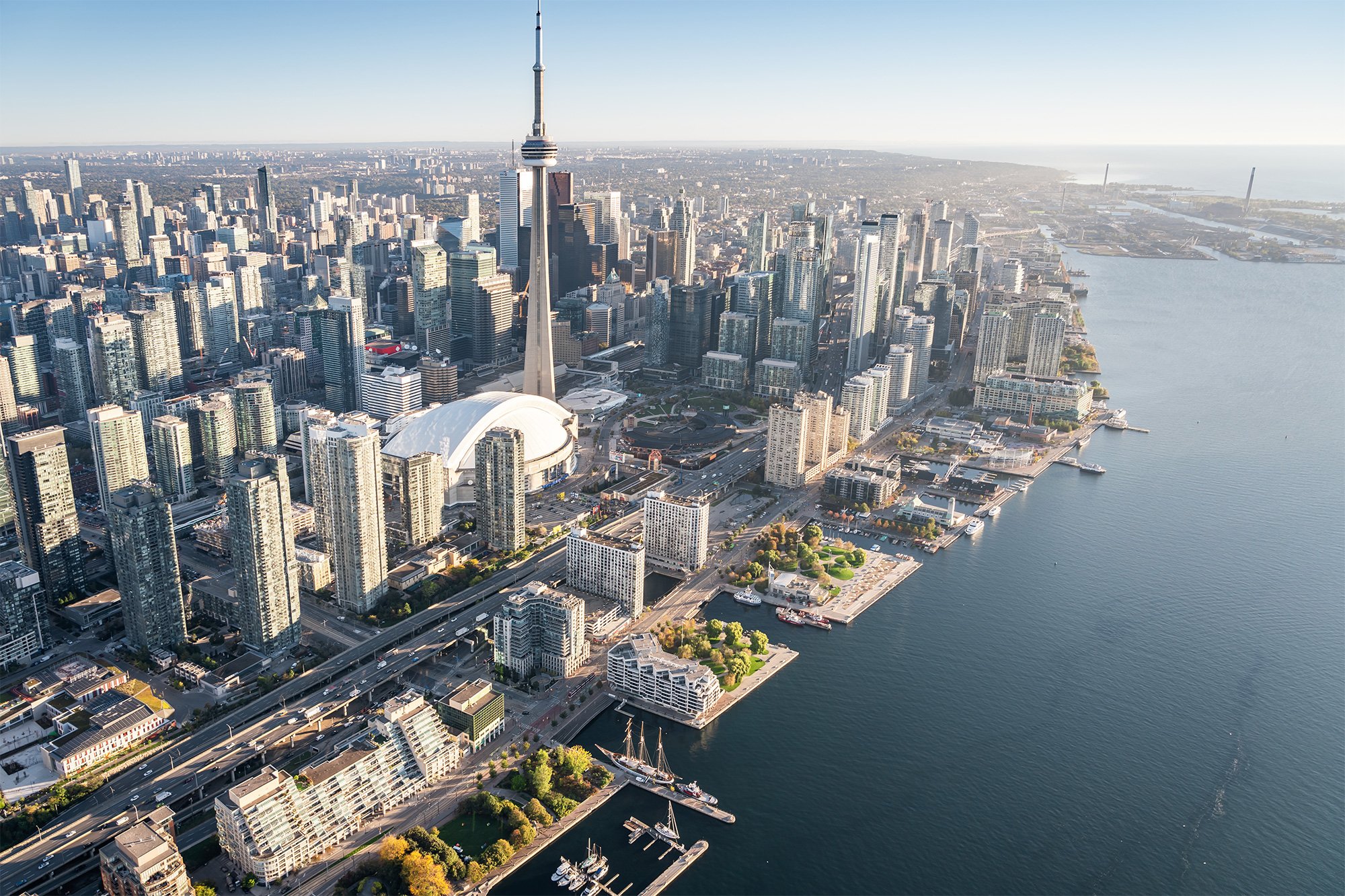
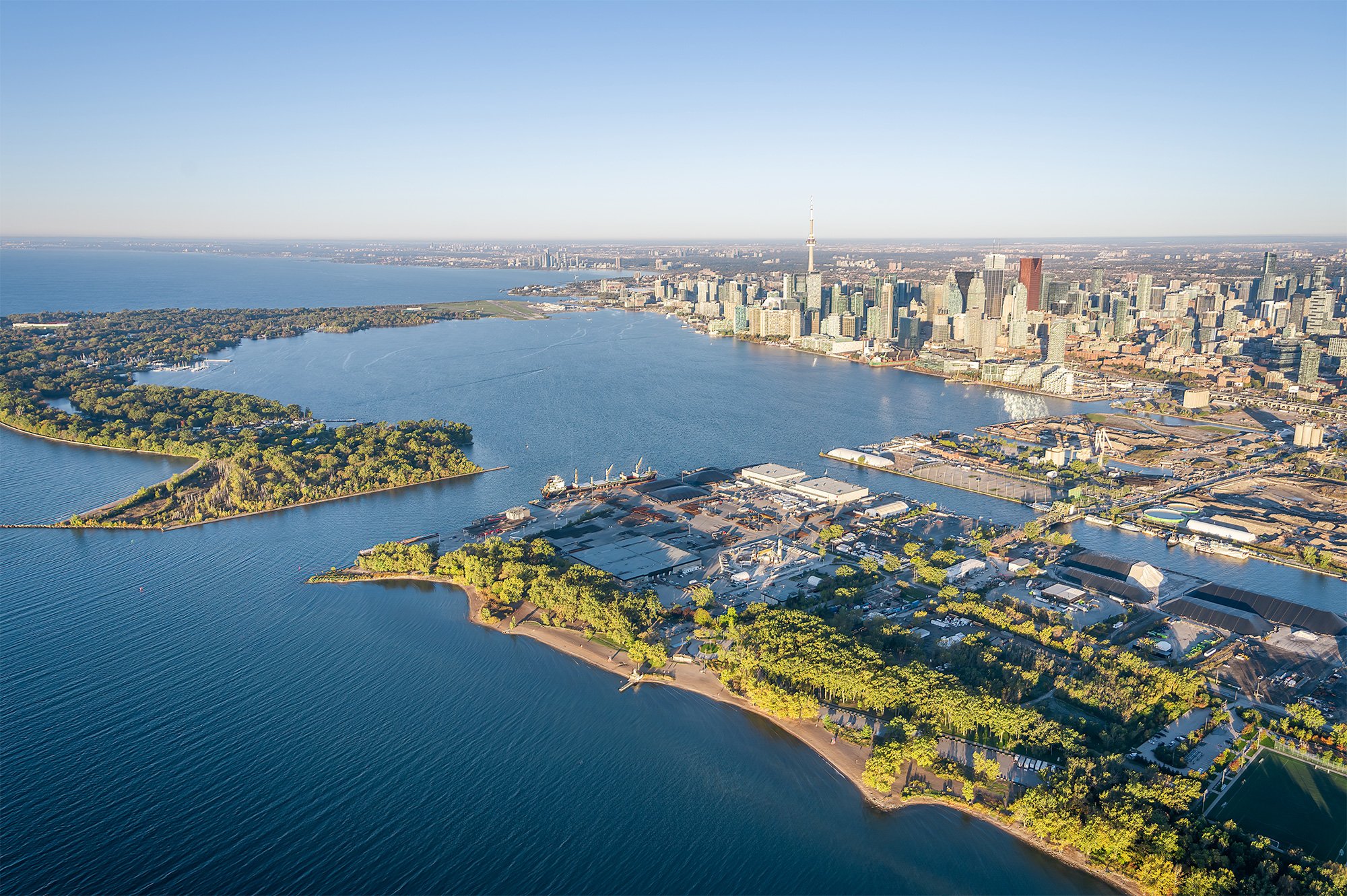
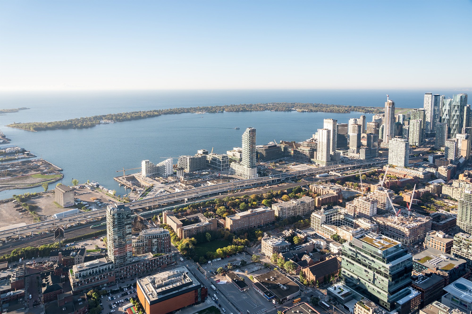
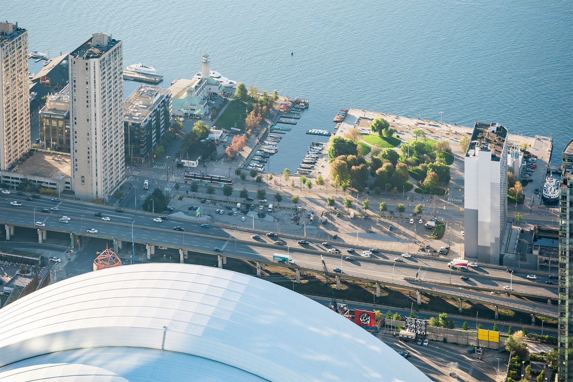
In the past few years Waterfront Toronto has made incredible progress advancing the development and construction of various projects along the Toronto lake edge. In particular, the Quay Side, Corktown Common, East Bayfront and Port Lands have come a long way with masterplans & visions for a resilient, flood protected and revitalized Don River Valley.
Waterfront Toronto needed updated photography for their reports and continued graphic communications, so together with Sarah Askett and Carolina Soderholm we went up with pilot Dave Tommasini from Four Seasons Aviation to capture the waterfront development in its best morning light.
Client: Waterfront Toronto
Role: Aerial Photography
Team: Sarah Askett, Carolina Soderholm
Year: 2021
Location: Toronto, Ontario
All images are property of Waterfront Toronto.
![CN Tower Aerial](https://images.squarespace-cdn.com/content/v1/5006edb7c4aabfac58363d93/1653922368825-3MYLVUDXMJWHBDDIYSWV/WEB_WFTO_Aerial-Selections-68.jpg)
CN Tower Aerial
![East Bayfront](https://images.squarespace-cdn.com/content/v1/5006edb7c4aabfac58363d93/1653922209068-DWQVUB6OT7SM52V8K1JC/WEB_WFTO_Aerial-Selections-8.jpg)
East Bayfront
![Sugar Beach](https://images.squarespace-cdn.com/content/v1/5006edb7c4aabfac58363d93/1666779712627-H6GQ923VKMG70VG75P5P/WEB_WFTO_Aerial-Selections-11.jpg)
Sugar Beach
![TTC Streetcar on Queen East](https://images.squarespace-cdn.com/content/v1/5006edb7c4aabfac58363d93/1653922270824-C3NU4FINZMQAC6K4VQTW/WEB_WFTO_Aerial-Selections-46.jpg)
TTC Streetcar on Queen East
![Corktown Commons to Downtown Toronto](https://images.squarespace-cdn.com/content/v1/5006edb7c4aabfac58363d93/1653922289566-ZN43A66N1VQFMBXHL39X/WEB_WFTO_Aerial-Selections-49.jpg)
Corktown Commons to Downtown Toronto
![Corktown Commons](https://images.squarespace-cdn.com/content/v1/5006edb7c4aabfac58363d93/1653922293352-HKMDLPRKUNPAZVJVJUIF/WEB_WFTO_Aerial-Selections-50.jpg)
Corktown Commons
![Flood Protection Landforms, Corktown Common](https://images.squarespace-cdn.com/content/v1/5006edb7c4aabfac58363d93/1653922299724-G471NXZ4ZSJXZVFR5PWT/WEB_WFTO_Aerial-Selections-48.jpg)
Flood Protection Landforms, Corktown Common
![Toronto Port Lands Towards Downtown](https://images.squarespace-cdn.com/content/v1/5006edb7c4aabfac58363d93/1666779716921-SCZQ4KD3CXIAUBTP0DAX/WEB_WFTO_Aerial-Selections-37.jpg)
Toronto Port Lands Towards Downtown
![Cherry Beach](https://images.squarespace-cdn.com/content/v1/5006edb7c4aabfac58363d93/1666779713398-BB0SZHEMUJYYZL2NEWI3/WEB_WFTO_Aerial-Selections-57.jpg)
Cherry Beach
![Toronto Skyline and Waterfront](https://images.squarespace-cdn.com/content/v1/5006edb7c4aabfac58363d93/1653922365898-MO3K8EMC9JH4CWT2H2QT/WEB_WFTO_Aerial-Selections-64.jpg)
Toronto Skyline and Waterfront
![Port Lands and Toronto Islands Skyline](https://images.squarespace-cdn.com/content/v1/5006edb7c4aabfac58363d93/1666779742081-DGFRSU9IV9EYLUQSXWU4/WEB_WFTO_Aerial-Selections-54.jpg)
Port Lands and Toronto Islands Skyline
![Quayside and East Bayfront](https://images.squarespace-cdn.com/content/v1/5006edb7c4aabfac58363d93/1653922411849-1LRLDEG5B55IY74E2JGA/WEB_WFTO_Aerial-Selections-84.jpg)
Quayside and East Bayfront
![Rees Park Aerial](https://images.squarespace-cdn.com/content/v1/5006edb7c4aabfac58363d93/1666779779623-Z6R6WA1Q71CH7TJ4GB64/WEB_WFTO_Aerial-Selections-72.jpg)